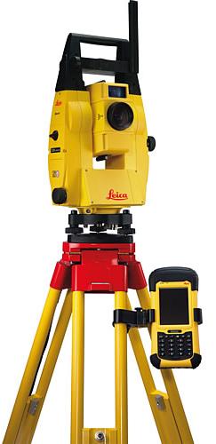
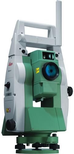
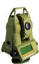
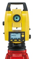
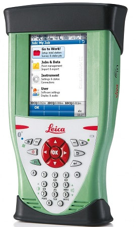
Leica iCON robot 50 is designed specifically for ease of use within the construction industry, simply level the instrument and go! With the iCONstruct software, you can use it for a wide range of measuring and positioning tasks on site.
Customer benefits
Most accurate reflectorless measurements in its class
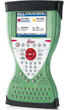
One-button keyboard for simple operation
PowerSearch (patented Search technology)
Superior tracking performance
Flexible data communication: WLAN (150m range) or Long-range Bluetooth® (350m). Simply upgrade your communication by swaping the instrument handle
Electronic Guide Light (EGL) assisting the operator with the prism targeting
Easy hand-over control from rover to machine control and vice versa
Wide range of applications with the custom-built iCONstruct software
Operates seamlessly with all Leica iCON sensors
-One-person robotic
Increase your productivity by working in one-person mode. With industry leading tracking performance and the patented PowerSearch technology, Leica iCON robot 50 allows you to finish jobs faster maintaining highest accuracy.
-Interior overhead with laser pointer
Using one of the world’s most accurate laser pointers, remotely lay-out points on walls for drill patterns or on ceilings for air conditioning or other such projects.
-Machine control
Work to the tightest tolerances under any site conditions. With Leica iCON robot 50 you can carry out fine grading and paving with highest precision speeding up your work with construction machinery.
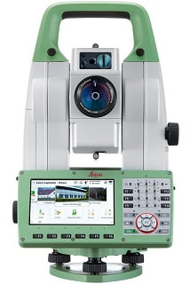
The unique capture-sketch-link functionality enables high resolution total station images to be captured, enhanced with sketching and then linked to any point of interest. Costly revisits can be avoided to significantly improve productivity. Every vision on every scale becomes reality with ease.
Best-in-class Imaging
Optimize your productivity with exact photo documentation of site conditions. With live streaming of the total station view, you always know what the total station sees.
Image Notes – Capture an image, screenshot or template, sketch on it and link it to any object in the database
Image Assisted Surveying – Use the camera's live streaming to speed up the aiming process
Best-in-class Electronic Distance Measurement (EDM)
With PinPoint EDM, Viva TPS delivers the optimal balance of range, accuracy, reliability, beam visibility, laser dot size and measurement time.
1 mm + 1.5 ppm to prism
2 mm + 2 ppm to any surface
1000 m range without a prism
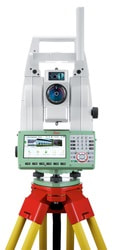
Leica Viva GNSS Add-on
Add full GNSS functionality to your Viva TS11 whenever you want and combine TPS and GNSS in the most efficient way.
Use SmartStation for TPS setup without the need of control points, traverses and resections
Angle and distance measurement (with Prism)
Leica Viva TPS precision angle measurement system operates continuously providing instant horizontal and vertical circle readings that are automatically corrected for any “out of level” by a centrally located twin-axis compensator. The coaxial EDM uses an infrared laser, has various measuring modes, and measures to prisms and reflective tape.The range is excellent – 3.5 km to a single prism – and the accuracy superb – 1 mm + 1.5 ppm. Resolution is 0.1 mm.
Fast, continuous, high-accuracy angle measurements
Choice of accuracy from 1 to 5 seconds
No initialization
Twin-axis compensator
EDM with standard, fast and tracking modes
Long range, fast measurements and high accuracy
Totally reliable
PinPoint - distance measurement without prism
PinPoint is the ideal tool for measuring to wall corners, inaccessible objects, facades, rock faces, roofs and walls inside buildings, in fact to anything at which it is difficult to set up a reflector.
PinPoint’s tightly bundled laser marks the point exactly with a small red dot. Measurements are taken instantly and directly (no complex routines measurement).
And with PinPoint you can also take very long distance measurements to prisms.
All Leica Viva TPS
Three versions: short range R30 (max. 30 m), standard range R400 (more than 400m),
superior range R1000 (more than 1000m)
Very small laser spot,marks the point exactly
Standard measurement and tracking modes
Accuracy as high as 2 mm depending on measuring mode,range and target surface
Motorized Leica Viva TPS with PinPoint – the perfect tool for grid scanning of plane surfaces
(e.g. facades), irregular surfaces (e.g. stockpiles), and measuring profiles and cross-sections
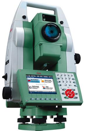
Imaging
The Viva TPS TS11 I and TS15 I Imaging Total Stations have been designed to optimally include imaging functionality for Image Assisted Surveying and Documentation. Through high quality optics, images from 2 m to infinity are transferred as sharp images to a high resolution 5 Mpixel CMOS camera.
A dedicated image processing board precisely calculates the exact exposure time and white balance settings for capturing optimal camera images of the total station live view. In order to support 20 Hz live streaming, new high-speed slip rings were designed and a state-of-the-art multimedia image processing unit was integrated to instantly transfer images from the telescope to the total stations high resolution VGA display.
Key components for the imaging functionality of the TS11 I & TS15 I are:¨
High quality optics (no distortions, fixed focus)
High resolution sensor (5 Mpx CMOS image sensor)
High performance image processing board
High speed slip rings
High performance processor (Freescale i.MX31, 533 MHz multimedia processor
with integrated image processing unit)
High resolution display (full VGA display)
Best-in-class Imaging
Optimize your productivity with exact photo documentation of site conditions. With live streaming of the total station view, you always know what the total station sees. Measure all points without returning to the total station.
- Image Notes: Capture an image, screenshot or template, sketch on it and link it to any object in the database
- Image Assisted Surveying: Simply tap on the display and the total station will turn and measure the desired target
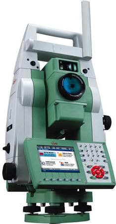
Best-in-class One-Person-Surveying
Viva TS15 uses years of experience to optimally combine the world’s best total station sensors: angles, distances, drives and the patented PowerSearch target recognition camera.
- Search: the unique PowerSearch finds your prism within seconds
- Lock: Viva TS15 stays locked onto your prism in the most demanding environments
- Measure: PinPoint EDM seamlessly harmonizes with precise angle sensors to complete the measurement process
Leica Viva GNSS Add-on
Add full GNSS functionality to your Viva TS15 whenever you want and combine TPS and GNSS in the most efficient way.
- Use SmartStation for TPS setup without the need of control points, traverses and resections
- Use SmartPole to save time with setup "On-the-fly" and measure parallel with TPS and GNSS for double productivity

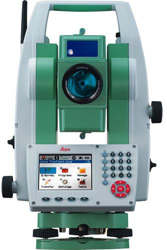
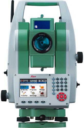
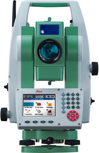
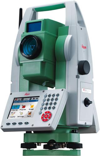
A true performance orientated Total Station that continually delivers regardless how demanding the task may be. Designed especially for mid-to-high accuracy applications. Equipped with all FlexLine features from removable USB memory, Bluetooth® wireless technology, Emitting Guide Light to a complete range of application software, your TS09 guarantees maximum performance. If more convenient, use Bluetooth® wireless technology to connect any data collector, e.g. the Leica CS10/15. Use SmartWorx Viva or the software which best suits your task and familiarity.
Color & Touch display and Leica FlexField plus Onboard Software
Work productively with the new Leica FlexField plus onboard software and the new color & touch display.
Fast navigation inside the software via touch screen, tabs and icons
High resolution color display to show all information without misinterpretation
Low learning curve due to guided workflows
Easy to understand graphics and icons
Best-in-class Electronic Distance Measurement (EDM)
With PinPoint EDM, FlexLine plus delivers the optimal balance of range, accuracy, reliability, beam visibility, laser dot size and measurement time.
1.5 mm + 2 ppm to prism
2 mm + 2 ppm to any surface
Extremely fast (1 second)
1000 m range without a prism
Coaxial laser pointer and measurement beam
Flexible Data Exchange
USB Stick for fast and easy transfer of data (GSI, DXF, ASCII, LandXML, CSV, user-defined)
Built-in wireless Bluetooth for cable-free connection to any data logger, e.g. the field controller Leica Viva CS10 or CS15
Theft protection by Leica Geosystems – mySecurity
mySecurity gives you total peace of mind
If your instrument is ever stolen, a locking mechanism is available to ensure that the device is disabled and can no longer be used
FlexField & FlexOffice Software
FlexField on-board software and optional FlexOffice Software offer a broad range of functionality to cover all tasks. Benefit from simplicity and functionality in one solution.
Application Programs Included:
Topography (Orientation & Surveying), Stake Out, Resection, Height Transfer, Construction, Area (Plan & Surface), Volume Calculation, Tie Distance (MLM), Remote Height, Hidden Point, Offset, Reference Line, Reference Arc, Reference Plane, COGO, Road 2D, Roadworks 3D, TraversePRO.
Package Includes:
796971: TS09 plus 5" (1.5 mgon) Total Station with Reflectorless R1000 EDM, 1 Full Keyboard, GSD04 Communication Kit Sidecover with USB Memory Stick, User Manual, and Container.
1yr Warranty and Basic Customer Care Package
Standard Accessory Set - consisting of:
Leica GDF111-1 Basic Tribrach Without Optical Plum
Leica GEB211 Li-Ion 2Ah Battery (x2)
Leica GKL211 Basic Battery Charger for GEB221/211
Leica GEV189 Data Transfer Cable Lemo - USB 2m
Leica GMP111-0 Basic Mini Prism & Pole
A true performance orientated Total Station that continually delivers regardless how demanding the task may be. Designed especially for mid-to-high accuracy applications. Equipped with all FlexLine features from removable USB memory, Bluetooth® wireless technology, Emitting Guide Light to a complete range of application software, your TS09 guarantees maximum performance. If more convenient, use Bluetooth® wireless technology to connect any data collector, e.g. the Leica CS10/15. Use SmartWorx Viva or the software which best suits your task and familiarity.
Color & Touch display and Leica FlexField plus Onboard Software
Work productively with the new Leica FlexField plus onboard software and the new color & touch display.
Fast navigation inside the software via touch screen, tabs and icons
High resolution color display to show all information without misinterpretation
Low learning curve due to guided workflows
Easy to understand graphics and icons
Best-in-class Electronic Distance Measurement (EDM)
With PinPoint EDM, FlexLine plus delivers the optimal balance of range, accuracy, reliability, beam visibility, laser dot size and measurement time.
1.5 mm + 2 ppm to prism
2 mm + 2 ppm to any surface
Extremely fast (1 second)
1000 m range without a prism
Coaxial laser pointer and measurement beam
Flexible Data Exchange
USB Stick for fast and easy transfer of data (GSI, DXF, ASCII, LandXML, CSV, user-defined)
Built-in wireless Bluetooth for cable-free connection to any data logger, e.g. the field controller Leica Viva CS10 or CS15
Theft protection by Leica Geosystems – mySecurity
mySecurity gives you total peace of mind
If your instrument is ever stolen, a locking mechanism is available to ensure that the device is disabled and can no longer be used
FlexField & FlexOffice Software
FlexField on-board software and optional FlexOffice Software offer a broad range of functionality to cover all tasks. Benefit from simplicity and functionality in one solution.
Application Programs Included:
Topography (Orientation & Surveying), Stake Out, Resection, Height Transfer, Construction, Area (Plan & Surface), Volume Calculation, Tie Distance (MLM), Remote Height, Hidden Point, Offset, Reference Line, Reference Arc, Reference Plane, COGO, Road 2D, Roadworks 3D, TraversePRO.
Package Includes:
785796: TS09 plus 3" (1 mgon) Total Station with Reflectorless R1000 EDM, 1 Full Keyboard, GSD04 Communication Kit Sidecover with USB Memory Stick, User Manual, and Container.
1yr Warranty and Basic Customer Care Package
Standard Accessory Set - consisting of:
Leica GDF111-1 Basic Tribrach Without Optical Plum
Leica GEB211 Li-Ion 2Ah Battery (x2)
Leica GKL211 Basic Battery Charger for GEB221/211
Leica GEV189 Data Transfer Cable Lemo - USB 2m
Leica GMP111-0 Basic Mini Prism & Pole
A true performance orientated Total Station that continually delivers regardless how demanding the task may be. Designed especially for mid-to-high accuracy applications. Equipped with all FlexLine features from removable USB memory, Bluetooth® wireless technology, Emitting Guide Light to a complete range of application software, your TS09 guarantees maximum performance. If more convenient, use Bluetooth® wireless technology to connect any data collector, e.g. the Leica CS10/15. Use SmartWorx Viva or the software which best suits your task and familiarity.
Color & Touch display and Leica FlexField plus Onboard Software
Work productively with the new Leica FlexField plus onboard software and the new color & touch display.
Fast navigation inside the software via touch screen, tabs and icons
High resolution color display to show all information without misinterpretation
Low learning curve due to guided workflows
Easy to understand graphics and icons
Best-in-class Electronic Distance Measurement (EDM)
With PinPoint EDM, FlexLine plus delivers the optimal balance of range, accuracy, reliability, beam visibility, laser dot size and measurement time.
1.5 mm + 2 ppm to prism
2 mm + 2 ppm to any surface
Extremely fast (1 second)
1000 m range without a prism
Coaxial laser pointer and measurement beam
Flexible Data Exchange
USB Stick for fast and easy transfer of data (GSI, DXF, ASCII, LandXML, CSV, user-defined)
Built-in wireless Bluetooth for cable-free connection to any data logger, e.g. the field controller Leica Viva CS10 or CS15
Theft protection by Leica Geosystems – mySecurity
mySecurity gives you total peace of mind
If your instrument is ever stolen, a locking mechanism is available to ensure that the device is disabled and can no longer be used
FlexField & FlexOffice Software
FlexField on-board software and optional FlexOffice Software offer a broad range of functionality to cover all tasks. Benefit from simplicity and functionality in one solution.
Application Programs Included:
Topography (Orientation & Surveying), Stake Out, Resection, Height Transfer, Construction, Area (Plan & Surface), Volume Calculation, Tie Distance (MLM), Remote Height, Hidden Point, Offset, Reference Line, Reference Arc, Reference Plane, COGO, Road 2D, Roadworks 3D, TraversePRO.
Package Includes:
785797: TS09 plus 2" (0.6 mgon) Total Station with Reflectorless R1000 EDM, 1 Full Keyboard, GSD04 Communication Kit Sidecover with USB Memory Stick, User Manual, and Container.
1yr Warranty and Basic Customer Care Package
Standard Accessory Set - consisting of:
Leica GDF111-1 Basic Tribrach Without Optical Plum
Leica GEB211 Li-Ion 2Ah Battery (x2)
Leica GKL211 Basic Battery Charger for GEB221/211
Leica GEV189 Data Transfer Cable Lemo - USB 2m
Leica GMP111-0 Basic Mini Prism & Pole
Performance on a Budget
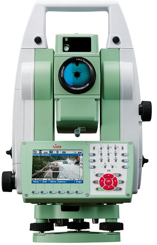
Leica Viva TS12 1" R1000 Total Station Performance Robotic package sets a new standard. Everything you need is in one package to begin efficient surveying today. Leica Viva TS12 is packed with features, such as the unique PowerSearch sensor which finds prisms regardless of their location in seconds and the light weight Leica CS10 controller which provides secure wireless connectivity to the total station. Together with the easy-to-use Leica SmartWorx Viva software, robotic surveying has never been so easy and productive.
Best-in-class Search-Lock-Measure
Leica Viva TS12 uses years of experience to optimally find, lock and measure to prisms with a single key press. With the unique PowerSearch sensor any prism type is found within seconds regardless of location.
Your benefit the fastest robotic total station in its class.
Best in class Radio field Controller
The ergonomic and light weight Leica CS10 Radio field controller with the fully integrated Intenna technology offers a long range, secure and fast wireless connectivity to your TS12 total station.
Your benefit ergonomic field solution.
Best-in-class Simplicity in the Field
SmartWorx Viva LT is designed with simplicity in mind using clear graphics, logical menu structures, non technical terminology and simplyfied workflows.
Package Includes:
1 TS12 A 7" R400 - Automatic Target Aiming
1 GDF121 Tribrach without Plummet
1 GST20-9 Wooden Heavy Duty Tripod
1 GKL211 Charger for GEB211 & GEB212 Batteries
1 GEV235-3 AC/DC Adapter UK Power Supply
2 GEB221 Battery, Internal, 4.4Ah Li-Ion
1 MCF256 CompactFlash Card 256MB
1 CS10 TPS/GNSS Field Controller with Internal TPS Radio Module & WLAN
1 CBC01 Lemo Connector Module with Power Jack, Lemo (USB & Serial) & USB A
1 SPF01 Anti-glare Display Foils for CS10 or CS15 Field Controller
1 SmartWorx Viva LT Licence Key
1 GHT62 Pole Holder Base Plate for CS10 and CS15 Field Controller
1 GHT63 Clamp Arrangement for Attaching the GHT39/56/62 Holder to all Poles
2 GEB212 Li-Ion Battery, 7.4V / 2.6Ah, Chargeable
1 RH15 Radio Handle with Integrated Modem
1 GVP642 Hard Container for GS15 SmartAntenna and CS15/CS10 Field Controller
1 GLS12 Aluminium SmartPole, Telescopic Snap-lock, CM
1 GRZ4 360° Prism
1 1 yr TS12 (incl. CS10) Basic Customer Care Package
Built-in user friendliness by the full alpha-numerical keyboard and the high resolution display
Fast and easy entry of numbers, letters and special characters, e.g. for coding
At-a-glance viewing on the largest high-resolution display in its class
Best-in-class Electronic Distance Measurement (EDM)
With PinPoint EDM, FlexLine plus delivers the optimal balance of range, accuracy, reliability, beam visibility, laser dot size and measurement time.
1.5 mm + 2 ppm to prism
2 mm + 2 ppm to any surface
Extremely fast (1 second)
1000 m range without a prism
Coaxial laser pointer and measurement beam
Flexible Data Exchange
USB Stick for fast and easy transfer of data (GSI, DXF, ASCII, LandXML, CSV, user-defined)
Built-in wireless Bluetooth for cable-free connection to any data logger, e.g. the field controller Leica Viva CS10 or CS15
Theft protection by Leica Geosystems – mySecurity
mySecurity gives you total peace of mind
If your instrument is ever stolen, a locking mechanism is available to ensure that the device is disabled and can no longer be used
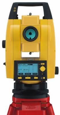
The Leica FlexLine TS02plus Manual Total Station is ideal for standard measurement tasks. It comes with a simple keyboard and a complete standard set of application software that guide you through your daily work.
State-of-the-art simplicity with the standard-keyboard and the high resolution display
- Low number of operating elements, whose functions are immediately apparent
- At-a-glance viewing on the largest high-resolution display in its class
- Optimally suited to new users and all those on the construction site who do not use the instrument daily
Best-in-class Electronic Distance Measurement (EDM)
With PinPoint EDM, FlexLine plus delivers the optimal balance of range, accuracy, reliability, beam visibility, laser dot size and measurement time.
- 1.5 mm + 2 ppm to prism
- 2 mm + 2 ppm to any surface
- Extremely fast (1 second)
- 400 m range without a prism
- Coaxial laser pointer and measurement beam
Work intuitively with the new Leica FlexField plus onboard software
- Low learning curve due to guided workflows
- Easy to understand graphics and icons
- Icons to quickly verify instrument status
- Faster operation due to graphics which make the interpretation of measurement values or text no longer necessary
Theft protection by Leica Geosystems mySecurity
- mySecurity gives you total peace of mind
- If your instrument is ever stolen, a locking mechanism is available to ensure that the device is disabled and can no longer be used
Pride in accuracy
Surveyors take great pride in accuracy. The Leica TS30 delivers impressive performance in individual disciplines. But most importantly it is a champion in perfectly combining angle measurement, distance measurement, automatic target recognition and motorisation. The accuracy of the Leica TS30 is in a league of its own, a true companion for surveyors with pride.
Leica TS30 accuracy - the facts:
Angular accuracy – 0,5”
Pinpoint EDM accuracy: 0.6 mm + 1 ppm to prism / 2 mm + 2 ppm to any surface
Automatic Target Recognition (ATR) accuracy – 1"
Performance that counts
Achieving both high performance and high accuracy is challenging. The Leica TS30 has reached a new level of performance, whereby high accuracy surveying can be achieved in an easy, fast and reliable way, regardless of the project demands.
World’s best Dynamic Tracking Performance
Fastest Start-to-Finish Workflow
Long service intervals
A winning team
Leica TS30 surveyors benefit from more than a total station. What first seems to be a total station, is actually one component in the most complete portfolio of solutions for precise surveying. The Leica TS30 offers unlimited flexibility and scalability through complete compatibility with System 1200 accessories.
Automated One-Person Surveying and GNSS Extension
Setting new benchmarks in trust
It all started more than 75 years ago with the Wild T3 precision theodolite that stunned the surveying community with highly accurate measurements. Now, four generations later, Leica Geosystems continues to build on the values of accuracy and quality. The latest generation of Champions, the Leica TS30 total station has reached the pinnacle. Generations of surveyors have trusted in accuracy and quality from Leica Geosystems, now it’s time to take this trust to the next level.
Angle Measurement
The angle measurement system - for horizontal and vertical angles - is a very significant component of the Leica TS30. It must guarantee highly precise and accurate angle measurements under the high speed performance of the direct drives.
Important characteristics and advantages of the Leica TS30 angle measurement are the high measurement frequency - up to 5000 angle measurements per second - and the quadruple angle detection system.
The angle measurement accuracy of the Leica TS30 is proven and certified by Leica Geosystems’ TPM-2. This Theodolite Test Machine is part of Leica Geosystems’ calibration laboratory for length and angle. The laboratory is accredited by the Swiss Accreditation Service SAS, which belongs to the Swiss Federal Department of Economic Affairs DEA. The standard deviation (1s) of the TPM-2 angle measurements are 0.018mgon (0.058”) for horizontal angles and 0.028mgon (0.091”) for vertical angles. To test the angle measurement accuracy of the Leica TS30, the horizontal and vertical angle measurements are compared with the measurements of the TPM-2.
The standard deviation is calculated according to ISO 17123-3. For the Leica TS30, the angle measurement accuracy is 0.15mgon (0.5”).
Motorization
The motorization of the Leica TS30 uses direct drives based on the piezo principle, which directly transforms electric power into mechanical movements.
The Leica TS30 is the only total station which uses direct drives based on the piezo principle for horizontal and vertical movements of its alidade and telescope.
The direct drives using piezo technology enable high speed motorization and acceleration capabilities together with infinitesimal step sizes at low power consumption. The step sizes reach the range of nanometers. Unmatched durability and extended maintenance cycles of the direct drives are achieved by a subsequent elimination of the transmission drives moving parts. No gears are used for the movements. Furthermore, the Leica TS30 direct drives do not produce a magnetic field nor are they affected by them. This guarantees the unrestricted operation of these direct drives in magnetic fields as they can appear for instance in electric power plants.
Compared to conventional drives, the main advantages of the Leica TS30 direct drives are the following properties:
High speed (up to 200gon/s)
High acceleration (up to 400gon/s2)
Long durability and robustness
No noise emission
Compact design
No power consumption at rest
Electro-optical Distance Measurement
For the electro-optical distance measurements (EDM) on prisms, reflector tapes or natural targets, a visible laser beam, which is coaxial to the optical axis, is transmitted by Leica Geosystems’ PinPoint EDMsystem.
Leica Geosystems’ reflectorless PinPoint R1000 EDM measures to natural targets at ranges of more than 1000m. To realize these long distance measurements without any prisms or reflector tapes, Leica Geosystems’ proven System Analyzer was implemented. This procedure allows the evaluation of the total signal information for the distance determination and combines the advantages of the phase and time-of-flight measurements without having their individual disadvantages.
For the Leica TS30 total station, the Leica PinPoint EDM was improved to achieve even greater accuracy. The established PinPoint EDM enables distance measurement accuracy, on Leica round prisms (GPH1P), of 0.6mm + 1ppm (tested according to ISO 17123-4).
The PinPoint EDM provides many advantages for the distance measurements of the Leica TS30 total station. Beside the very high measurement quality and reliability, the Leica PinPoint EDM allows measurements even under adverse atmospheric conditions, such as dust, smoke, mist, rain or snowfall, etc.
Beside electronic and signal analyzing improvements of the distance measurements, the shape of the laser beam was significantly improved. This results in an optimized laser beam profile and footprint.
Cross-sectional Drawing
This picture shows a cross-sectional drawing of the Leica TS30. The drawing visualizes, in particular, the position and size of the horizontal and vertical coded glass circles.
The coded glass circles are part of the horizontal and vertical angle measurement systems. An important influence to angle measurement precision and resolution are the size of these circles. A larger diameter improves the angular precision and resolution. Therefore, the diameter of the Leica TS30 coded glass circles have been enlarged approximately 15% compared to typical 1”-total stations. The design and construction of the standards and the alidade considers the size of the enlarged coded glass circles.
Complete Monitoring Integration
The Leica TM30 forms one component of a unique Monitoring solution which seamlessly integrates total stations, GNSS receivers and antennas, geotechnical sensors, software and IT communication infrastructures.
Leica GeoMoS software provides a highly fl exible automatic deformation monitoring system that is able to combine geodetic, geotechnical and meteorological sensors to match the needs of your monitoring project, whether it is large or small, temporary or permanent.
Leica GeoMoS Web is a web based service for the visualization and analysis of monitoring data collected by a Leica GeoMoS monitoring system. Access your monitoring project anywhere, anytime using your web browser, pocket pc or mobile phone.
Accurate, Fast and Silent
The Leica TM30 is designed to meet the highest accuracy standards. High precision measurements, combined with automatic, fast and silent operation ensures that the TM30 detects the smallest movement in all monitoring applications.
High accuracy angular measurement of 0,5'' or 1''
Pinpoint EDM accuracy
0.6 mm + 1 ppm to prism
2 mm + 2 ppm to any surface
Move, Lock, Measure, Transmit
Fastest workflow for the overall measurement process.
Zero noise pollution
Robust and Reliable
Critical man-made structures and natural phenomenon need to be measured continuously. The Leica TM30 will operate 24 hours a day, 365 days a year, and continue to deliver top quality measurements. The TM30 is built to be tough and to be left unattended in remote, hostile environments. The Leica TM30 distinguishes itself with robustness, reliability, minimal maintenance and lowest power consumption.
Continuous operation
Long service intervals
Theft protection and keyboard lock
Lowest Power Consumption
SmartEye Vision
Leica SmartEye vision is the combination of long range Automatic Target Recognition (ATR), TargetView and TargetCapture technology. The TM30 is the only sensor combining long range with exceptionally high accuracy to meet the demands of any monitoring application.
Long range ATR
3000m with 7 mm accuracy
TargetView
Detects the correct prism when multiple prisms are close together
TargetCapture
With the target capture technology obstructions in the line of site can be inspected remotely
Angle Measurement
The angle measurement system - for horizontal and vertical angles - is a very significant component of the Leica TM30. It must guarantee highly precise and accurate angle measurements under the high speed performance of the direct drives.
Important characteristics and advantages of the Leica TM30 angle measurement are the high measurement frequency - up to 5000 angle measurements per second - and the quadruple angle detection system.
The angle measurement accuracy of the Leica TM30 is proven and certified by Leica Geosystems’ TPM-2. This Theodolite Test Machine is part of Leica Geosystems’ calibration laboratory for length and angle. The laboratory is accredited by the Swiss Accreditation Service SAS, which belongs to the Swiss Federal Department of Economic Affairs DEA. The standard deviation (1s) of the TPM-2 angle measurements are 0.018mgon (0.058”) for horizontal angles and 0.028mgon (0.091”) for vertical angles. To test the angle measurement accuracy of the Leica TS30, the horizontal and vertical angle measurements are compared with the measurements of the TPM-2.
The standard deviation is calculated according to ISO 17123-3. For the Leica TM30, the angle measurement accuracy is 0.15mgon (0.5”).
Motorization
The motorization of the Leica TM30 uses direct drives based on the piezo principle, which directly transforms electric power into mechanical movements.
The Leica TM30 is the only total station which uses direct drives based on the piezo principle for horizontal and vertical movements of its alidade and telescope.
The direct drives using piezo technology enable high speed motorization and acceleration capabilities together with infinitesimal step sizes at low power consumption. The step sizes reach the range of nanometers. Unmatched durability and extended maintenance cycles of the direct drives are achieved by a subsequent elimination of the transmission drives moving parts. No gears are used for the movements. Furthermore, the Leica TM30 direct drives do not produce a magnetic field nor are they affected by them. This guarantees the unrestricted operation of these direct drives in magnetic fields as they can appear for instance in electric power plants.
Compared to conventional drives, the main advantages of the Leica TM30 direct drives are the following properties:
High speed (up to 200gon/s)
High acceleration (up to 400gon/s2)
Long durability and robustness
No noise emission
Compact design
No power consumption at rest
Electro-optical Distance Measurement
For the electro-optical distance measurements (EDM) on prisms, reflector tapes or natural targets, a visible laser beam, which is coaxial to the optical axis, is transmitted by Leica Geosystems’ PinPoint EDMsystem.
Leica Geosystems’ reflectorless PinPoint R1000 EDM measures to natural targets at ranges of more than 1000m. To realize these long distance measurements without any prisms or reflector tapes, Leica Geosystems’ proven System Analyzer was implemented. This procedure allows the evaluation of the total signal information for the distance determination and combines the advantages of the phase and time-of-flight measurements without having their individual disadvantages.
For the Leica TM30 total station, the Leica PinPoint EDM was improved to achieve even greater accuracy. The established PinPoint EDM enables distance measurement accuracy, on Leica round prisms (GPH1P), of 0.6mm + 1ppm (tested according to ISO 17123-4).
The PinPoint EDM provides many advantages for the distance measurements of the Leica TM30 total station. Beside the very high measurement quality and reliability, the Leica PinPoint EDM allows measurements even under adverse atmospheric conditions, such as dust, smoke, mist, rain or snowfall, etc.
Beside electronic and signal analyzing improvements of the distance measurements, the shape of the laser beam was significantly improved. This results in an optimized laser beam profile and footprint.
An all new Leica Geosystems proprietary direct drive technology has been designed from the ground up for this new sensor. Based on Piezo technology, these new direct drives enable high speed motorization and acceleration, at up to 4x the previous generation, but still allow sub micron level fine positioning. This technology has very low power consumption, requires almost no maintenance and is near silent.
Combined with the right software package like DCP05 or Microlog, the Leica TDRA6000 is a top level solution for industrial metrology.
TCA1800
Universal total station for demanding surveying tasks with high accuracy requirements. Angle measuring accuracy of 1” (0.3 mgon)
TC2003 / TCA2003
Robust precision total station for the highest requirements in surveying with an angle measuring accuracy of 0.5” (0.15 mgon)
Angle & distance measurement
The total stations have a specially-manufactured angle measuring system that facilitates a measuring accuracy of 0.15mgon (0.5") on the TC2003 and TCA2003. Key elements here are the precise drives and the quadruple detection of the graduated circles.
All total stations are equipped with coaxial precision distancers. On the TC2003 and TCA2003, a distance measuring accuracy of 1mm+1ppm is achieved due to the use of specially-developed components.
Robustness
The technology has already been proven many thousands of times all over the world and is extremely reliable. Due to the high stability and the long service life of the gearboxes on the automatic instruments, the total stations are particularly suitable for continuous use such as monitoring tasks or for the control of machinery. With IP54 the total stations are very well protected against dust and water.
Automatic fine pointing
The Automatic Target Recognition (ATR) demonstrates its full benefits during routine repeat measurements, e.g. monitoring, set measurements and measurement at two telescope faces. Using the sight, the observer aligns the telescope roughly with the target point and triggers a distance measurement. The total station automatically moves the telescope to the centre of the prism, measures the distance and corrects the angle 1 mm with the deviation to the centre of the prism.
Automatic target tracking
In the LOCK mode the instrument automatically tracks the reflector after the first measurement. With a single button press, all measured values can be recorded at any time without the need to interrupt target tracking.
Measurement is particularly convenient using the 360° reflector, as this does not need to be aligned.
RCS remote control
Using the Remote Control System (RCS), which is connected to the total station via an integrated radio modem, you can measure just as easily from the target as from the instrument itself. Display and keypad on the remote control are fully compatible with the total station. All functions and programs can be accessed from the remote control and operation is identical to the total station. Perfect for robotic or one-person surveying.
With SmartStation you don’t need to worry about control points, traverses and resections. Just set up wherever it’s convenient, touch the GPS key and let the SmartAntenna do the rest. RTK determines the position to centimeter accuracy within a few seconds at ranges up to 50 km from a reference station. With SmartStation you’re ready to go in the shortest possible time; fix the position with GNSS/GPS and then survey with the total station.
GNSS/GPS fully integrated into total station
With the entire software in the total station, all TPS and GNSS/GPS operations are controlled via the TPS keyboard. All data are stored in the same database on the same CompactFlash card. All measurement, status and other information are displayed on the TPS screen. The TPS plug-in battery also powers the GNSS/GPS SmartAntenna and RTK communication device. All components combine perfectly. Everything is integrated into one compact unit – no need for cables, external battery, data logger etc.
Use as SmartStation, or as a total station and RTK rover
With SmartStation’s modular design, you can use the equipment in any way you like. Use SmartStation when there are no control points available. Once SmartStation is accurately positioned, take off the SmartAntenna, put it on a pole, and use it with the RX1210 controller and GTX1230 sensor as a fully-fledged RTK rover. You’re totally flexible with SmartStation.
Leica GNSS technology (GPS and GLONASS)
futureproof
Add additional GLONASS satellites to the world’s best-performing GPS reference station systems. Track all available GNSS signals now. An upgrade to GPS L5 and Galileo will be readily available as these systems become operational. Leica Geosystems GPS solutions proven reliability rises to the next level with full GNSS support to deliver unmatched results with SmartTrack+ and SmartCheck+.
Leica SmartRTK: Always in focus
logo_smartrtk_90x90Users of GNSS Reference Station Networks expect their results to be consistent throughout the com-plete Network, but often they’re unaware that virtually computed Reference Stations compromise con-sistency. Only with Leica Geosystems ingenious SmartRTK can you be sure that you’re getting the best performance of your complete GNSS system. Even the new RTCM 3.1 International standard now includes correction data designed by Leica Geosystems to ensure that the results are consistent and traceable anywhere in the network. And the new atmospheric decorrelator technology provides precise positioning in all Networks regardless of the correction data.
Black Tribrach w/o optical plummet
Battery, Charger (complete with car adapter cable)
Builder Prism, Mini Reflector Pole set with point
Data Cable TS to USB, USB Memory Stick
User Manual
Carry Case
Technical Support
Leica Builder 400 Total Station Product Information
The Leica Builder 400 total station - the high performer in its league! With all the same great features of the Builder 100-300 the Leica Builder 400 has the additional benefits of full-alphanumeric keyboard and prism measurment mode. if you are looking for a highly accurate total station that offers good value, then the Leica Builder 400 is the right instrument for you.
Leica Builder 400 Total Station Options
The Leica Builder 200 is available in two accuracies:
Builder 409 - 9" Angle Measurement
Builder 405 - 5" Angle Measurement
Leica Builder 400 Total Station Technical Specification:
Multiligual function
If you have a crew that speak different languages then the Leica Builder 400 is the ideal theodolite for you. The Leica Builder is the only instrument in its class that comes with multiple languages on-board. Switching between languages is quick and simple with only one keystroke improving convenience and efficiency. 3 Languages can be displayed at the same time on the Builder.
With “Direct.dxf” functionality, data can be read directly from the instrument in dxf-format and read into AutoCAD® on a PC without any intermediate steps. Coordinates and point numbers can be stored in different layers.
Theft protection
The Leica Builder 400 comes with a PIN-code feature to prevent unauthorised persons from using the instrument. This increases your data security. Without correct code, the equipment cannot be operated, data erased and makes it unattractive to steal. This protects you from having damages, increases your safety and possibly lowers your insurance rates.
Black Tribrach w/o optical plummet
Battery, Charger (complete with car adapter cable)
Builder Prism, Mini Reflector Pole set with point
Data Cable TS to USB, USB Memory Stick
User Manual
Carry Case
Leica Builder 500 Total Station Product Information
The Leica Builder 500 is the "flagship" of the Builder Total Station Series. Equipped to a very high specification the Leica Builder 500 will get the job done with speed and accuracy. Whatever the your job requires the Leica Builder 500 has the high end specification to match.
Leica Builder 500 Total Station Options
The Leica Builder 500 is available in two accuracies:
Builder 509 - 9" Angle Measurement
Builder 506 - 5" Angle Measurement
Builder 503 - 3" Angle Measurement
Leica Builder 500 Total Station Technical Specification:
Multiligual function
If you have a crew that speak different languages then the Leica Builder 500 is the ideal theodolite for you. The Leica Builder is the only instrument in its class that comes with multiple languages on-board. Switching between languages is quick and simple with only one keystroke improving convenience and efficiency. 3 Languages can be displayed at the same time on the Builder.
With “Direct.dxf” functionality, data can be read directly from the instrument in dxf-format and read into AutoCAD® on a PC without any intermediate steps. Coordinates and point numbers can be stored in different layers.
Theft protection
The Leica Builder 500 comes with a PIN-code feature to prevent unauthorised persons from using the instrument. This increases your data security. Without correct code, the equipment cannot be operated, data erased and makes it unattractive to steal. This protects you from having damages, increases your safety and possibly lowers your insurance rates.
Black Tribrach w/o optical plummet
Battery, Charger (complete with car adapter cable)
Double sided Flat Prism
Mini Reflector Pole set with point with Clip on Bubble
Data Cable TS to USB, USB Memory Stick
Carry Case
Leica Builder 300 Total Station Product Information
The Leica Builder 300 total station is an all-round instrument. Whether you require a total station that performs routine surveying tasks or a professional highly accurate instrument, the Leica Builder 300 has all the features to meet your demands.
Leica Builder 300 Total Station Options
The Leica Builder 200 is available in two accuracies:
Builder 309 - 9" Angle Measurement
Builder 306 - 6" Angle Measurement
Leica Builder 300 Total Station Technical Specification:
Multiligual function
If you have a crew that speak different languages then the Leica Builder 300 is the ideal theodolite for you. The Leica Builder is the only instrument in its class that comes with multiple languages on-board. Switching between languages is quick and simple with only one keystroke improving convenience and efficiency. 3 Languages can be displayed at the same time on the Builder.
With “Direct.dxf” functionality, data can be read directly from the instrument in dxf-format and read into AutoCAD® on a PC without any intermediate steps. Coordinates and point numbers can be stored in different layers.
Theft protection
The Leica Builder 300 comes with a PIN-code feature to prevent unauthorised persons from using the instrument. This increases your data security. Without correct code, the equipment cannot be operated, data erased and makes it unattractive to steal. This protects you from having damages, increases your safety and possibly lowers your insurance rates.

A true performance orientated Total Station that continually delivers regardless how demanding the task may be. Designed especially for mid-to-high accuracy applications. Equipped with all FlexLine features from removable USB memory, Bluetooth® wireless technology, Emitting Guide Light to a complete range of application software, your TS09 guarantees maximum performance. If more convenient, use Bluetooth® wireless technology to connect any data collector, e.g. the Leica CS10/15. Use SmartWorx Viva or the software which best suits your task and familiarity.
Color & Touch display and Leica FlexField plus Onboard Software
Work productively with the new Leica FlexField plus onboard software and the new color & touch display.
Fast navigation inside the software via touch screen, tabs and icons
High resolution color display to show all information without misinterpretation
Low learning curve due to guided workflows
Easy to understand graphics and icons
Best-in-class Electronic Distance Measurement (EDM)
With PinPoint EDM, FlexLine plus delivers the optimal balance of range, accuracy, reliability, beam visibility, laser dot size and measurement time.
1.5 mm + 2 ppm to prism
2 mm + 2 ppm to any surface
Extremely fast (1 second)
1000 m range without a prism
Coaxial laser pointer and measurement beam
Flexible Data Exchange
USB Stick for fast and easy transfer of data (GSI, DXF, ASCII, LandXML, CSV, user-defined)
Built-in wireless Bluetooth for cable-free connection to any data logger, e.g. the field controller Leica Viva CS10 or CS15
Theft protection by Leica Geosystems – mySecurity
mySecurity gives you total peace of mind
If your instrument is ever stolen, a locking mechanism is available to ensure that the device is disabled and can no longer be used
FlexField & FlexOffice Software
FlexField on-board software and optional FlexOffice Software offer a broad range of functionality to cover all tasks. Benefit from simplicity and functionality in one solution.
Application Programs Included:
Topography (Orientation & Surveying), Stake Out, Resection, Height Transfer, Construction, Area (Plan & Surface), Volume Calculation, Tie Distance (MLM), Remote Height, Hidden Point, Offset, Reference Line, Reference Arc, Reference Plane, COGO, Road 2D, Roadworks 3D, TraversePRO.
Package Includes:
TS09 plus 2" (0.6 mgon) Total Station with Reflectorless R500 EDM, 1 Full Keyboard, GSD04 Communication Kit Sidecover with USB Memory Stick, User Manual, and Container.
1yr Warranty and Basic Customer Care Package
Standard Accessory Set - consisting of:
Leica GDF111-1 Basic Tribrach Without Optical Plum
Leica GEB211 Li-Ion 2Ah Battery (x2)
Leica GKL211 Basic Battery Charger for GEB221/211
Leica GEV189 Data Transfer Cable Lemo - USB 2m
Leica GMP111-0 Basic Mini Prism & Pole
A true performance orientated Total Station that continually delivers regardless how demanding the task may be. Designed especially for mid-to-high accuracy applications. Equipped with all FlexLine features from removable USB memory, Bluetooth® wireless technology, Emitting Guide Light to a complete range of application software, your TS09 guarantees maximum performance. If more convenient, use Bluetooth® wireless technology to connect any data collector, e.g. the Leica CS10/15. Use SmartWorx Viva or the software which best suits your task and familiarity.
Color & Touch display and Leica FlexField plus Onboard Software
Work productively with the new Leica FlexField plus onboard software and the new color & touch display.
Fast navigation inside the software via touch screen, tabs and icons
High resolution color display to show all information without misinterpretation
Low learning curve due to guided workflows
Easy to understand graphics and icons
Best-in-class Electronic Distance Measurement (EDM)
With PinPoint EDM, FlexLine plus delivers the optimal balance of range, accuracy, reliability, beam visibility, laser dot size and measurement time.
1.5 mm + 2 ppm to prism
2 mm + 2 ppm to any surface
Extremely fast (1 second)
1000 m range without a prism
Coaxial laser pointer and measurement beam
Flexible Data Exchange
USB Stick for fast and easy transfer of data (GSI, DXF, ASCII, LandXML, CSV, user-defined)
Built-in wireless Bluetooth for cable-free connection to any data logger, e.g. the field controller Leica Viva CS10 or CS15
Theft protection by Leica Geosystems – mySecurity
mySecurity gives you total peace of mind
If your instrument is ever stolen, a locking mechanism is available to ensure that the device is disabled and can no longer be used
FlexField & FlexOffice Software
FlexField on-board software and optional FlexOffice Software offer a broad range of functionality to cover all tasks. Benefit from simplicity and functionality in one solution.
Application Programs Included:
Topography (Orientation & Surveying), Stake Out, Resection, Height Transfer, Construction, Area (Plan & Surface), Volume Calculation, Tie Distance (MLM), Remote Height, Hidden Point, Offset, Reference Line, Reference Arc, Reference Plane, COGO, Road 2D, Roadworks 3D, TraversePRO.
Package Includes:
785795: TS09 plus 1" (0.3 mgon) Total Station with Reflectorless R500 EDM, 1 Full Keyboard, GSD04 Communication Kit Sidecover with USB Memory Stick, User Manual, and Container.
1yr Warranty and Basic Customer Care Package
Standard Accessory Set - consisting of:
Leica GDF111-1 Basic Tribrach Without Optical Plum
Leica GEB211 Li-Ion 2Ah Battery (x2)
Leica GKL211 Basic Battery Charger for GEB221/211
Leica GEV189 Data Transfer Cable Lemo - USB 2m
Leica GMP111-0 Basic Mini Prism & Pole
The Leica Builder 200 has been designed and manufactured in-line with Leica’s total-station range providing outstanding quality and accuracy in an easy-to-use package.
The rugged Leica Builder 200 provides a laser plummet for simple and fast setup over control points, dual axis compensation for accurate plumbing, endless drives eliminating steps, audible notice for 90° turns, graphical leveling aid for fast and convenient setup.
Distance measuring
The Leica Builder 200 can measure distances to a range of 250m, alongside recording of angluar measurements. However if you would prefer to measure to a traditional glass prisms with a range of 500m, then the Builder 400 & 500 models with be the choice.
Reflectorless distance measuring
The reflectorless system allows the Leica Builder 200 to under measuring tasks to any surface to a range of 80m / 260 ft. The laser point allows fast aiming onto the target point.
IP55
With IP55 rating, the Leica Builder 200 can withstand most environments commonly found on a construction site.
Two accuracies available
Builder 209 - 9” accuracy
Builder 206 - 6” accuracy
However, if you require full alphanumeric keyboard with wireless communication, then the Leica Builder 300, 400 and 500 verions are worth the extra investment.
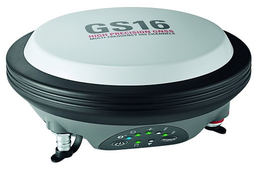
Meet the most compact and powerful self-learning GNSS smart antenna! The Leica Viva GS16 incorporates the leading RTK technology for the highest standards in measurement excellent with RTKplus and SmartLink. This clever GNSS receiver is able to be more selective about what signal it uses with RTKplus intelligently adapting to changing conditions.
With the Leica GS16, you get uninterrupted accurate positioning even when your local correction service is unavailable due to problems with network coverage. Even when no reference data is available, you can work fully remotely with SmartLink.
This Leica GNSS smart antenna can be configured with the new Captivate software, transforming your complex data into the most realistic and workable 3D models. With simple apps and familiar touch technology, all your measurement and design data can be viewed in all dimensions.
The GS16 can be used alongside the powerful handheld Leica CS20 Controller and Leica CS35 Tablet for full control with convenience and mobility.
Built for harsh environmental demands, the Leica GS15 features protection against dust and water up to IP67 rating and can function even after a 2m survey pole fall or a drop to the ground of up to 1m. This reliable GNSS receiver comes with features to improve the accuracy of your data such as SmartCheck and SmartTrack and the integrated web server allows you to configure your data logging.
FEATURES
IP67 Protection
1.34kg Weight (GS15)
-40 to +65° Operating Temperature
Integrated Web Interface
LED Indicator
Bluetooth Communication
Leica Viva GS25 is designed to work in the most extreme environments. With its IP68 protection against dust and water and the internal battery charger, the GS25 keeps on going even in remote locations. This surveying receiver comes with integrated web interface for configuration options and it can withstand a drop up to 1m onto a hard surface.
FEATURES
IP68 Protection
1.84kg Weight (GS15)
-40 to +65° Operating Temperature
Integrated Web Interface
LED Indicator
Bluetooth Communication
GNSS receiver check out the Leica Viva GS10. Built for extreme temperatures of -40°C to +65°C the GS10 is perfect for all your measuring tasks.
This GNSS receiver is protected to IP68 standard against dust and water and can withstand falls of up to 1m to the ground or from a 2m survey pole toppling over, making the GS10 suitable for tough working conditions. With functions including SmartCheck and SmartTrack, you can be sure of reliable results and accurate signal tracking.
Peak Performance when with external high precision antennas such as the Leica AS10, AR10, AR20 or AR25
Great for Reference and Rover setups
GNSS Technology
RTK Static Mode:
FEATURES
IP68 Protection
0.93kg Weight (GS14)
-40 to +65° Operating Temperature
LED Indicator
Bluetooth Communication
Peak Performance with external high precision antenna AS10, AR10, AR20 or AR25
Integrated Web Server
Horizontal: 5 mm + 0.5 ppm (rms)
Vertical: 10 mm + 0.5 ppm (rms)
Compliant to ISO 17123-8 standard
GNSS receiver, look no further than the Leica Viva GS14. Including integrated mobile communications and additional web interface, the GS14 is perfect for all your measuring tasks.
This GNSS receiver is protected to IP68 standard against dust and water and can withstand falls of up to 1m to the ground or from a 2m survey pole toppling over, making the GS14 suitable for tough working conditions. With functions including SmartCheck and SmartTrack, you can be sure of reliable results and accurate signal tracking.
CS10 are versatile controllers to work with many instruments and software combinations:
Ideal for use with all Leica Viva and Nova series total stations and GNSS sensors
Perfectly designed to be used with SmartWorx Viva surveying software
Powerful ARM core processor for many software applications
Flexible communication and data handling
Stay connected with a wide range of communication and data storage options. With fully integrated wireless Intenna technology (Bluetooth®, GSM/UMTS 3.5G, WiFi), a choice of two connector modules and data storage using an SD card or USB memory stick, your Viva CS15 and CS10 are ready for all challenges on site and in the office.
Leica Viva CS15 controller is an effective wireless field controller which comes with capable and easy to understand software to increase both work production and quality with your Leica Viva GNSS GS08 Plus Receiver.
Suited for extreme environments, the Leica CS15 controller has an IP67 rating and is protected against dust, water and drops of just over a metre. Its operating temperature ranges between -30 to 60° C and is ergonomically designed to be comfortable in the hand. It is equipped with a fully illuminated QWERTY 65 key keypad and includes a 2 megapixel camera which can take pictures in the hand or when mounted on a pole. The CS15 also has the added benefit of displaying information using its fully illuminated VGA landscape colour touch screen.
The Leica CS15 comes with Bluetooth® wireless connectivity, WLAN, 1 GB non-volatile flash storage and USB connector, 2.4GHz radio with internal antenna and 3.5G modem.
This controller package comes installed with Leica SmartWorx Full
The Leica CS15 at a glance:
Leica Viva CS15 Field Controller
Operating System: Windows CE 6.0
SmartWorx Viva FULL
Standard software included: Internet Explorer Mobile, Word Mobile, Windows Media Player, Camera software.
Built in 3.5G internet modem
WLAN
Bluetooth connectivity
SD card, CF card & USB compatible
2MP Camera
Audio speaker
Weight: 0.56Kg
Size: 200mm/120mm/45mm
Removable GEB212 rechargeable battery
2 hours charging time
10 hours operating time
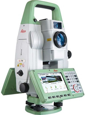
Leica Viva TS16 R1000 Total-Station Includes:
TS16P 1" R1000 Total Station
2-Color 5" Keyboard/Touchscreen
Leica Captivate software- Measure & Stakeout
GDF321 Tribrach
GEB222 Li-Ion battery
GKL311 Charger
MSD1000 SD Memory Card 1 GB
Hard carrying case
Manual
1-year manufacturer’s warranty
ATRplus
Range up to 1,500 m
Lock prism with range up to 1,000 m
Accelerated search PowerSearch target
MEASUREMENT ASSISTED IMAGE
Wide-angle camera of 5 megapixels
Video frame rate of 20 Hz on board and remote
Automatic capture panoramic image
PINPOINT R1000 DISTANCE MEASUREMENT
Visible beam measuring small spot size
Measuring range on any surface up to 1000 m
Leica Captivate
Software immersive experience
WVGA screen 5 "
Meet the world’s first self-learning total station. Automatically adjusting to any environmental conditions, the Leica Viva TS16 locks onto your, and only your, target. Regardless of how challenging the task or the amount of distractions in the field, this total stations exceeds your expectations.
This model is a Power Search (P) model, which features an advanced prism search mode for use as a robotic total station. Other available models are are Automated (A) with automatic target recognition, and Imaging (I) with a 5MP overview camera.
Models are either R500 or R1000 (relectorless measurement up to 500m or 1000m).
Use On-Board data collection or choose between Leica's CS20 field controller or G35 tablet (sold separately).
Package includes:
TS16P 3" R500 Total Station
Color 5" Keyboard/Touchscreen (1)
Leica Captivate SW- Measure & Stakeout
GDF321 Tribrach
GEB222 Li-Ion battery
GKL311 Charger
MSD1000 SD Memory Card 1 GB
User Manual
Hard carrying case
New Leica Viva TS16 P 5" R500 Total Station with CS20 3.75G Field Controller - 3 year Manufacturer Warranty
The world’s first self-learning total station automatically adjusts to any environment, locking on to your, and only your, target.
Leica Viva TS16 Power search R500 Complete Includes:
- 822454 LEICA TS16 P 5" (1.5mgon) R500 Total Station
- 827646 Leica Captivate software (Measure and Stakeout) - TS16/TS60/MS60
- 777508 GDF321 Tribrach without Plummet
- 799187 GKL341 Multi-bay Charging Station
- 733270 GEB221 Li-Ion Battery (x2)
- 6009581 1year Captivate TPS (TS16+CS20) DP Basic CCP
The Leica Viva TS16 Total Station comes with the revolutionary Captivate software, turning complex data into the most realistic and workable 3D models. With easy-to-use apps and familiar touch technology, all forms of measured and design data can be viewed in all dimensions. Leica Captivate spans industries and applications with little more than a simple swipe, regardless of whether you work with GNSS, total stations or both.
Infinitely bridging the field to the office
While Leica Captivate captures and models data in the field, Leica Infinity processes the information back in the office. A smooth data transfer ensures the project stays on track. Leica Captivate and Leica Infinity work in conjunction to join previous survey data and edit projects faster and more efficiently.
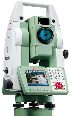
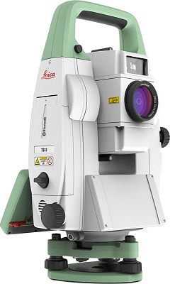
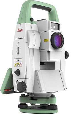
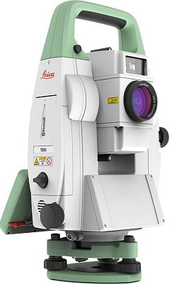
Leica Viva TS11, is the most advanced manual total station with the inclusion of Leica SmartWorx Viva easy-to-use onboard software, imaging and GNSS capability. With a complete package of easy-to-use software your work can start immediately and be finished faster than ever before. Add full GNSS functionality to your Viva TS11 whenever you want and combine TPS and GNSS in the most efficient way. Or use imaging with the unique capture-sketch-link functionality. High resolution total station images can be captured, enhanced with sketching and then linked to any point of interest. Costly revisits can be avoided to significantly improve productivity. Every vision on every scale becomes reality with ease.
Leica TS 11 5" R1000 Total Station is one of the most advanced with SmartWorx Viva Software package to complete jobs quicker and easier than ever before. Enabling GNSS functionality to the TS11 couldn’t be easier and is available as and when you need.
With combined TPS and GNSS, the Leica TS11 Total Station is more efficient and the touch screen option lets you capture images, sketch and link to any points of interest showing exact photo documentation relating to a specific site and avoiding costly revisits. For your future jobs, your Viva TS11 is already designed with GNSS and you can add the Viva GNSS antenna to your Total Station to become a SmartStation.
FEATURES
Accurancy 1mm + 1.5 ppm to prism and 2mm + 2ppm to any Surface
1000m Range without a Prism
Coaxial Laser Pointer and Measurement Beam
Extremely Fast
Leica TS-11-2" R1000 Total Stationis the most advanced manual total station with the inclusion of Leica SmartWorx Viva easy-to-use onboard software, imaging and GNSS capability. With a complete package of easy-to-use software your work can start immediately and be finished faster than ever before. Add full GNSS functionality to your Viva TS11 whenever you want and combine TPS and GNSS in the most efficient way. Or use imaging with the unique capture-sketch-link functionality. High resolution total station images can be captured, enhanced with sketching and then linked to any point of interest. Costly revisits can be avoided to significantly improve productivity. Every vision on every scale becomes reality with ease.
Leica Viva TS11 Total Station 2
Reflectorless Range: Imaging: 1000m Non Imaging: 500m or 1000m1 GB internal Flash Memory
Laser plummet
1 keyboard with full VGA colour touch screen
Bluetooth / RS232 / USB / SD card interface
RadioHandle interface
SmartWorx Viva software and DVD
SmartWorx Viva TS licence key
GDF321 Tribrach without plummet
GEV267 USB Cable
GKL341 Charging station
GEB221 Li-Ion Battery x2
Calibration Certificate - 1 Year
1yr Warranty and Basic Customer Care Package
User Manual
Carry Case
A new standard for efficient surveying
The Leica TS13 is a mid-range upgradeable total station, powered by Leica Captivate software and can be connected to the CS20 field controller.
The TS13 provides a fast, reliable and efficient solution tailored to the user’s needs to measure and layout points. Equipped with Automatic Target Recognition (ATR) technology and optionally with target lock and SpeedSearch to find and lock onto prisms quickly, it provides accurate measuring to targets. Combined with Leica Captivate field software, the TS13 offers the simplest and productive way of coding and line work.
Bridging the field to the office
The TS13 works with the revolutionary Leica Captivate field software, turning complex data into the most realistic and workable 3D models. It spans industries and applications with little more than a simple swipe, regardless of whether you work with GNSS, total stations or both.
A smooth data transfer ensures the project stays on track. Captivate and Leica Infinity office software work in conjunction to join previous survey data and edit projects faster and more efficiently.
Equipped with Automatic Target Recognition (ATR) technology and optionally with target lock and SpeedSearch to find and lock on to prisms quickly, it provides accurate measuring to targets. Combined with Leica Captivate field software, the TS13 offers a simple and productive way of coding and line work.
The TS13 works with the revolutionary Leica Captivate field software, turning complex data into the most realistic and workable 3D models. It spans industries and applications with little more than a simple swipe, regardless of whether you work with GNSS, total stations or both. A smooth data transfer ensures the project stays on track. Captivate and Leica Infinity office software work in conjunction to join previous survey data and edit projects faster and more efficiently.
and can be connected to a Leica CS20 field controller. It can be upgraded at any time to benefit from additional functionalities.
Engaging software
The Leica TS13 robotic total station solution works with the revolutionary Leica Captivate software, turning complex data into the most realistic and workable 3D models. With easy-to-use apps and familiar touch technology, all forms of measured and design data can be viewed in all dimensions. Captivate spans industries and applications with little more than a simple swipe.
Infinite possibilities
While Leica Captivate captures and models data in the field, Leica Infinity processes the information back in the office. A smooth data transfer ensures the project stays on track. Captivate and Infinity work in conjunction to join previous survey data and edit projects faster and more efficiently.
Upgradable
The Leica TS13 total station provides a fast, reliable and efficient solution tailored to the users needs to measure and layout more points. Equipped with Automatic Target Recognition (ATR) technology and optionally with target lock and SpeedSearch to find and lock on to prisms quickly, it provides accurate measuring to targets. Combined with Leica Captivate field software, the TS13 offers a simple and productive way of coding and line work.
Option «Lock»: enables the prism lock (following a prism) powered by ATR
Option «Display and Keyboard Unit»: Full 5’’ WVGA colour&touch screen
he new Leica TS13 mid range Robotic total station provides a fast and reliable solution in challenging site environments. ATR (automatic target recognition) with target lock and SpeedSearch options enable the TS13 to quickly aquire and track prisms for one person surveying and setting out tasks. packed with features for easy and productive robotic surveying and setting out
ATR (automatic target recognition) with target lock and SpeedSearch
available with the light weight Leica CS20 controller providing secure wireless connectivity to the total station
prism tracking between 1.5 and 3500 meters
500 meter reflectorless PinPoint for measuring to wall corners, inaccessible objects, facades, rock faces, roofs and walls and inside buildings
optional TS display and keyboard
Leica Viva TPS precision angle measurement system operates continuously providing instant horizontal and vertical circle readings that are automatically corrected for any “out of level” by a centrally located twin-axis compensator. The coaxial EDM uses an infrared laser, has various measuring modes, and measures to prisms and reflective tape.The range is excellent – 3.5 km to a single prism – and the accuracy superb – 1 mm + 1.5 ppm. Resolution is 0.1 mm.
Fast, continuous, high-accuracy angle measurements
Choice of accuracy 1, 2, 3 and 5 seconds
Twin-axis compensator
EDM with standard, fast and tracking modes
Long range, fast measurements and high accuracy
Totally reliable
automatic target aiming (ATR) - for uniform measurement accuracy. Also has lock mode to allow tracking of a moving reflector
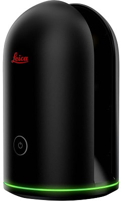
The Leica BLK360 is the world’s smallest imaging laser scanner, simplifying the collection of accurate 3D imagery and measurements.
The BLK360 shoots 360˚ high dynamic range (HDR) spherical imagery and combines it with an accurate 3D laser point-cloud.
The Leica BLK360 is the world’s smallest imaging laser scanner, simplifying the collection of accurate 3D imagery and measurements.
The BLK360 shoots 360˚ high dynamic range (HDR) spherical imagery and combines it with an accurate 3D laser point-cloud.
Designed to simplify the reality capture process, the BLK360 has only one button and produces digital reality data in under 3 minutes.
Its 0.5 - 60 metre range and optimisation for both indoor and outdoor use makes it the ideal close to-mid range reality capture device.
This compact 3D scanner uses laser 3D scanning technology to capture its environment in 3D. In addition to its LIDAR (Light Detection and Ranging) sensor the BLK360 offers infrared sensors for thermal imaging and 360˚ images.
Using the ReCAP Pro 360 mobile app, the BLK360 streams image and point cloud data to an iPad. The app then filters and registers scan data in real-time. After capture, ReCap 360 enables the point cloud data to be transferred to a number of CAD, BIM, VR and AR applications.
All this comes in a battery-powered, black aluminium device that’s light and small enough to fit into your hand.
Leica BLK360 System Package:
Leica BLK360 Imaging Laser Scanner
Leica BLK360 Transport Hood
Leica GEB212 Lithium-Ion Battery x2
Leica GKL312 Battery Charger
Leica GEV192-9 AC/DC Adapter
Leica BLK360 Tripod
Leica BLK360 Mission bag
Leica BLK360 Quick Guide
Leica BLK USB Documentation Card
Leica BLK360 App Info Sheet
Leica User Info Guide
Autodesk Recap360 Info Sheet
12 Months Recap Pro Subscription
Leica BLK360 1 Year Warranty Extension
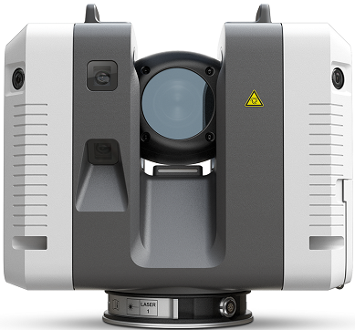
The Leica RTC360 3D laser scanner empowers users to document and capture their environments in 3D, improving efficiency and productivity in the field and in the office through fast, simple-to-use, accurate, and portable hardware and software. The RTC360 3D laser scanner is the solution for professionals to manage project complexities with accurate and reliable 3D representations and discover the possibilities of any site.
Highly portable, highly automated, intuitive and designed for maximum productivity, the RTC360 solution efficiently combines the RTC360 a high-performance 3D laser scanner, Leica Cyclone FIELD 360 mobilde-device app for edge computing for automatically registering scans in real time, and Leica Cyclone REGISTER 360 office software to integrate your 3D model seamlessly into your workflow.
Capture scans, including enriching High-Dynamic Range (HDR) imagery, in less than two minutes.
Automatically record your moves from station to station to pre-register your scans in the field without manual intervention. Augment your data capture with information tags illustrating the opportunities for better planning, reflect site reality, and boost your teams’ situational awareness.
Kit contains:
-RTC 3D Laser Scanner
-GVP730 hard carrying case
-GEB361 batteries (4)
-GKL341 Multicharger Pro
-RTC360 Flash Drive- 256GB (2)
-RTC360 Rain Cover
-1 year RTC360 CCP Basic (Customer Care Package)
Accomplished Scanning
The Leica ScanStation P30 is a highly adaptable scanner appropriate for a range of classic scanning solutions. Its combination of range, speed and accuracy paired with matchless sturdiness it is the comprehensive solution for a broad range of applications.
The ScanStation P40 offers uppermost adaptability including extended range abilities. Delivering exceptional speed, range and data quality wherever and wherever required. It is the ultimate solution for any 3D laser scanning task.
The Correct Choice
Whether acquiring 3D geometry of civil infrastructure, generating an as-built illustration of an industry development or producing 3D data for Building Information Modelling (BIM), you will need a true long range scanning instrument for projects. The Leica ScanStation P30 and P40 laser scanners are the best choice.
Extreme Performance in Tough Environments
The Leica P30 and P40 bring the highest quality HDR imaging and 3D data at a scan rate of 1 mio points p/second at distances of up to 270 meters. Supreme angular accuracy and range combined with survey-grade dual-axis compensation and low range noise form the basis for highly comprehensive 3D point clouds (colour) mapped in lifelike clarity.
Decreased Downtime
The robust ScanStations function under the harsh working conditions, such as intense temperatures varying from – 20°C to + 50°C and conform to the IP54 rating for water and dust resistance.
Comprehensive Scanning Solutions
Leica ScanStation portfolio from Leica Geosystems comes as an integrated piece of a comprehensive scanning solution. Data can be processed in the foremost 3D point cloud software suite, consisting of Leica Cyclone, Leica CloudWorx and the free Leica TruView.
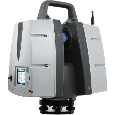
Every detail matters
For professionals looking to scan inaccessible locations, the Leica ScanStation P50 is the most rapid and safest, long-range 3D laser scanner. Unlike other laser scanners, the P50 solution exploits productivity by scanning difficult to reach places in a safe position on site, saving time with fewer setups.
Scan inaccessible locations
The Leica ScanStation P50 delivers maximum quality HDR imaging and 3D data at an exceptionally fast scan rate of up to 1 mio points per second and ranges of more than 1 km. Unmatched distance and angular precision combined with survey-grade dual-axis compensation and low range noise form the basis for well detailed 3D colour point clouds mapped in clarity.
Great performance in severe conditions
The very durable ScanStation P50 delivers even under the harshest environmental conditions, such as temperatures ranging from -20°C to + 50°C and conforms to the IP54 rating for water and dust resistance.
Complete scanning solution
The new P50 ScanStation is provided as part of a comprehensive scanning solution including hardware, software, training, service and support. 3D laser scan data can be processed in the leading 3D point cloud software suite, which consists of Leica Cyclone, Leica CloudWorx, Leica JetStream and the cost-free Leica TruView.
Highest quality 3D data and HDR imaging
Extremely high-speed scan rate of 1 mio points per second
Ranges of up to 1 kilometre
Low range noise
Survey-grade dual-axis compensation

The Leica ScanStation P40 offers the highest versatility including long range (up to 885 ft/270m at 34% reflectivity), speed (up to 1 million points per second), and accuracy (3D positional accuracy of 3mm at 50m; 6mm at 100m). Delivering outstanding range, speed and data quality whenever and wherever needed- it's the perfect solution for any task in 3D laser scanning.
The right choice
Whether capturing 3D geometry of civil infrastructure, creating an as-built representation of a large industry complex, reconstructing a crime scene or generating 3D data for integration into Building Information Modelling (BIM), you know you’ll need an accurate long range scanning tool for your projects – the new ScanStation P30 and P40 laser scanners from Leica Geosystems are the right choice, because every detail matters.
High performance under harsh conditions
The Leica ScanStations deliver highest quality 3D data and HDR imaging at an extremely fast scan rate of 1 million points per second at ranges of up to 270 m. Unsurpassed range and angular accuracy paired with low range noise and survey-grade dual-axis compensation form the foundation for highly detailed 3D color point clouds mapped in realistic clarity.
Reduced downtime
The extremely durable new laser scanners perform even under the toughest environmental conditions, such as extreme temperatures ranging from – 20°C to + 50°C and comply with the IP54 rating for dust and water resistance.
Complete scanning solutionLeica Geosystems offers the new Leica ScanStation portfolio as an integrated part of a complete scanning solution including hardware, software, service, training and support. 3D laser scanner data can be processed in the industry’s leading 3D point cloud software suite, which consists of Leica Cyclone stand-alone software, Leica CloudWorx plug-in tools for CAD systems and the free Leica TruView.
